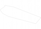
Sint Maarten Map - SVG Vector
Interactive Map of Sint Maarten
Sint Maarten is a Constitutional monarchy founded in 2010 and located in the area of North America, with a land area of 35 km² and population density of 1229 people per km². Territory of Sint Maarten borders Caribbean sea. Gross domestic product (GDP) is of about 794700 millions of dollars dollars.
Geography of Sint Maarten
200 m SW of Flagstaff Peak is the highest point in Sint Maarten at an altitude of 383 meters, instead the lowest point in the country is Caribbean Sea at sea level.
Simple Maps of Sint Maarten
Here are the best maps of Sint Maarten at high resolution. Below you find printable maps showing Sint Maarten in different styles and positions.
Frequently asked questions about Sint Maarten
How is Sint Maarten divided?
If you are looking for regions or provinces in Sint Maarten, here are all the main areas:
- Sint Maarten
What are the main points of interest in Sint Maarten?
The major tourist attractions in Sint Maarten are Maho Beach, Mullet Bay Beach, Great Bay Beach, Dawn Beach, Fort Amsterdam, Simpson Bay Lagoon, Front Street, Rainforest Adventures St Maarten, Little Bay Beach.
What is the flag of Sint Maarten?
What is the capital of Sint Maarten?
The main city and capital of Sint Maarten is Philipsburg.
What is the currency in Sint Maarten?
Official currency of Sint Maarten is Guilder.
What is the population of Sint Maarten?
In Sint Maarten there are 43000 people.
What is international phone code in Sint Maarten?
Sint Maarten telephone code is 1-721.


