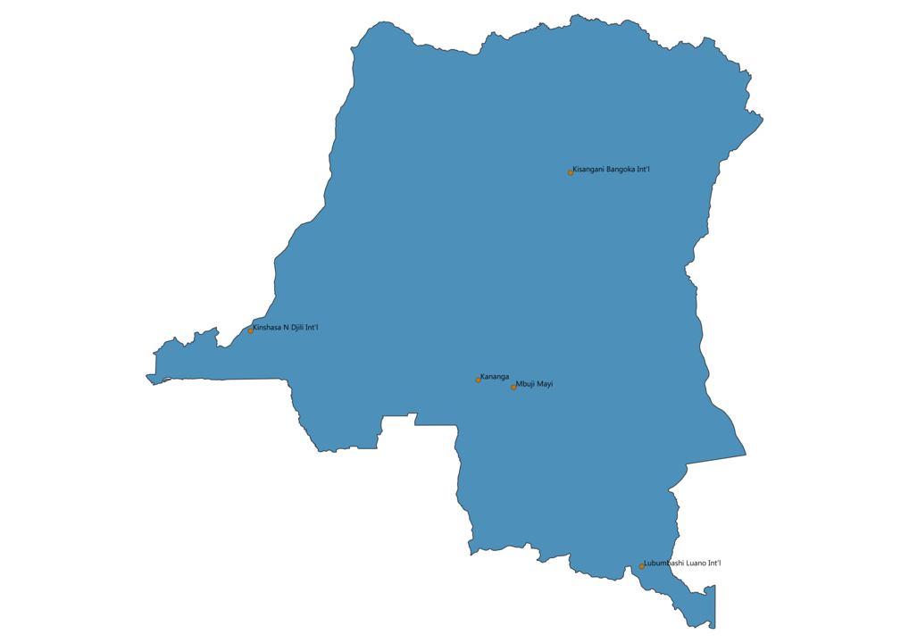
Airports in Democratic Republic of the Congo Map - SVG Vector

Airports in Democratic Republic of the Congo map vector is a file editable with Adobe Illustrator or InkScape. You can download SVG, PNG and JPG files.
This lossless scalable map of airports in Democratic Republic of the Congo is ideal for websites, printing and presentations related to flights.
The map of Democratic Republic of the Congo showing international airports offers a list of the major airports and where they are located in the country.
List of airports in Democratic Republic of the Congo
- Ndjili International Airport
- Ndolo Airport
- Bandundu Airport
- Kikwit Airport
- Mbandaka Airport
- Gbadolite Airport
- Gemena Airport
- Lisala Airport
- Bangoka International Airport
- Matari Airport


