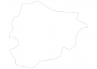
Andorra Map - SVG Vector
Interactive Map of Andorra
Andorra is a Constitutional monarchy founded in 1278 and located in the area of Europe, with a land area of 469 km² and population density of 165 people per km². Territory of Andorra borders France, Spain. Gross domestic product (GDP) is of about 480000 millions of dollars dollars.
Geography of Andorra
Coma Pedrosa is the highest point in Andorra at an altitude of 2942 meters, instead the lowest point in the country is Gran Valira at 840 m.
Simple Maps of Andorra
Here are the best maps of Andorra at high resolution. Below you find printable maps showing Andorra in different styles and positions.
Frequently asked questions about Andorra
How is Andorra divided?
If you are looking for regions or provinces in Andorra, here are all the main areas:
- Ordino
- Canillo
- Encamp
- La Massana
- Sant Julià de Lòria
- Escaldes-Engordany
- Andorra la Vellam
What are the main points of interest in Andorra?
The major tourist attractions in Andorra are Grandvalira, Arinsal and Pal Ski Area, Ordino Arcalís estación de esquí, Coma Pedrosa, Madriu-Perafita-Claror Valley, Església de Sant Esteve, Lake Engolasters, Casa de la Vall, Casa d’Areny-Plandolit.
What is the flag of Andorra?
What is the capital of Andorra?
The main city and capital of Andorra is Andorra la Vella.
What is the currency in Andorra?
Official currency of Andorra is Euro.
What is the population of Andorra?
In Andorra there are 77300 people.
What is international phone code in Andorra?
Andorra telephone code is 376.


