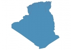
Algeria Map - SVG Vector
Interactive Map of Algeria
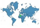
Algeria is a Republic founded in 1962 and located in the area of Africa, with a land area of 2381741 km² and population density of 18 people per km². Territory of Algeria borders Libya, Mali, Mauritania, Morocco, Niger, Tunisia, Western Sahara. Gross domestic product (GDP) is of about 216000 millions of dollars dollars.
Geography of Algeria
Mount Tahat is the highest point in Algeria at an altitude of 3003 meters, instead the lowest point in the country is Chott Melrhir at −40 m.
Simple Maps of Algeria
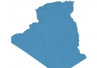
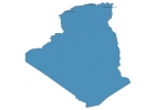
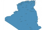
Here are the best maps of Algeria at high resolution. Below you find printable maps showing Algeria in different styles and positions.
Frequently asked questions about Algeria
How is Algeria divided?
If you are looking for regions or provinces in Algeria, here are all the main areas:
- Adrar
- Tamanghasset
- Tindouf
- Béchar
- El Tarf
- El Oued
- Tébessa
- Souk Ahras
- Ouargla
- Illizi
- Naâma
- Tlemcen
- Annaba
- Skikda
- Jijel
- Béjaïa
- Tizi Ouzou
- Boumerdès
- Alger
- Tipaza
- Chlef
- Mostaganem
- Oran
- Aïn Témouchent
- Sétif
- Bordj Bou Arréridj
- Bouira
- Blida
- Tissemsilt
- Aïn Defla
- Relizane
- El Bayadh
- Saïda
- Sidi Bel Abbès
- Mascara
- Ghardaïa
- Laghouat
- Médéa
- Tiaret
- M’Sila
- Batna
- Khenchela
- Guelma
- Constantine
- Mila
- Oum el Bouaghi
- Biskra
- Djelfa
What are the main points of interest in Algeria?
The major tourist attractions in Algeria are Monument of the martyr, Botanical garden El-Hamma Jardin d’Essai, Fort Santa Cruz, Bardo National Museum of Prehistory and Ethnography, Basilique Notre Dame d’Afrique, Beni Hammad Fort, Palais des Rais, Tikjda, maison de parc national de gouraya.
What is the flag of Algeria?
What is the capital of Algeria?
The main city and capital of Algeria is Algiers.
What is the currency in Algeria?
Official currency of Algeria is Dinar.
What is the population of Algeria?
In Algeria there are 43924900 people.
What is international phone code in Algeria?
Algeria telephone code is 213.
